
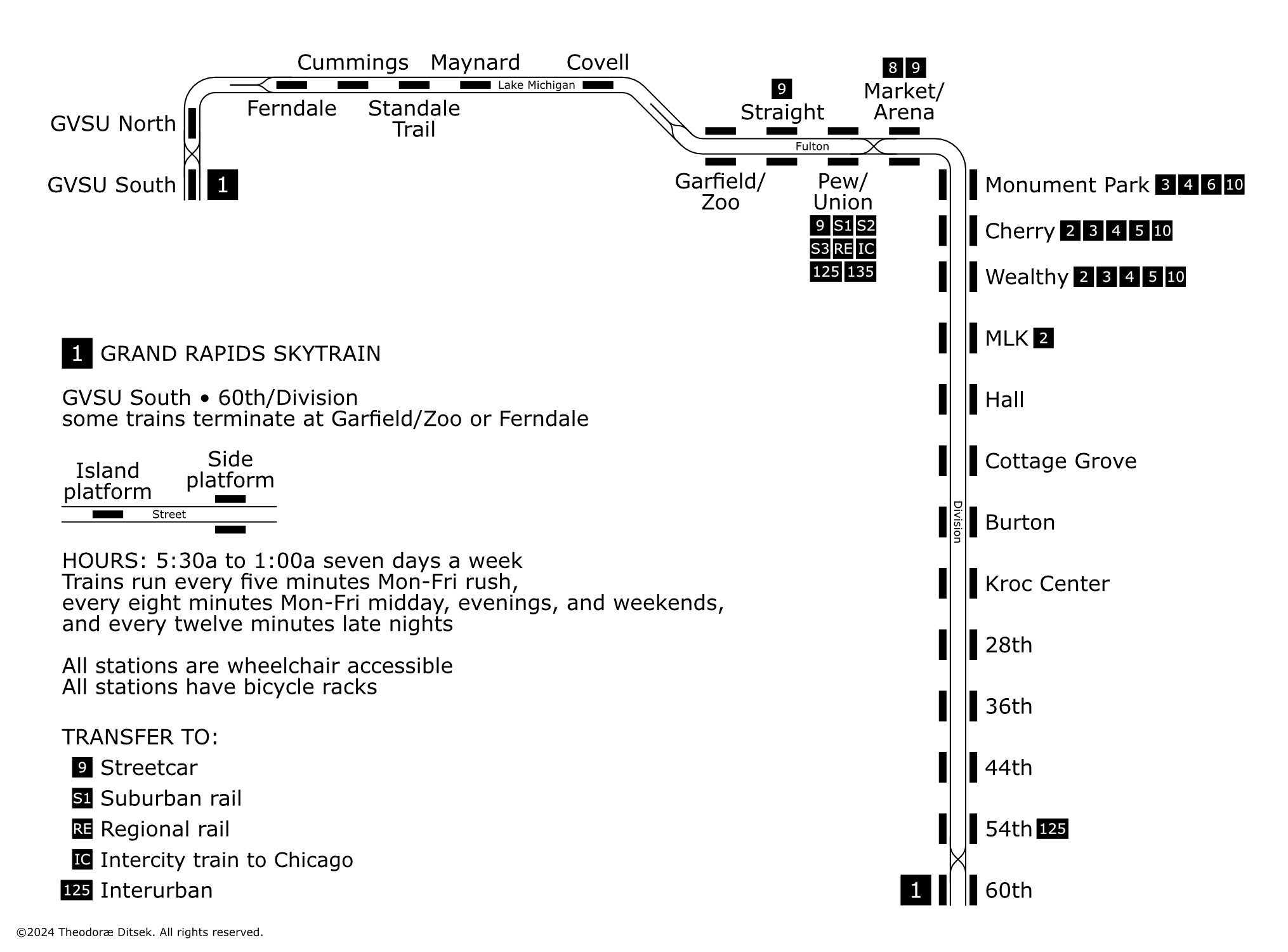
A quick one I whacked together in a couple hours before my laptop goes into the shop for some repairs. This map describes an elevated rail system for Grand Rapids, Michigan, similar to what was built in Brescia, Lille, or Copenhagen; using a routing similar to the Silver and Laker Line BRT systems. I’m always really fascinated with mass transit systems in smaller cities like Eugene, or Albany, or Fort Collins, or (yes) Grand Rapids, and I’ve wanted to draw a fantasy system based on those networks for a while.
This was meant to be a somewhat minimalist diagram (which might sell the actual system’s graphic design a bit short, considering its wayfinding somehow manages to make Trebuchet MS look good), so to make the project interesting for me I decided to draw the system as a track map, showing island platforms, side platforms, crossover tracks, and tail tracks. The only things not shown are the 60th and Ferndale yards. This was something I’d wanted to do for various smaller systems for years.
Lore: sometime in the 60s the Grand Rapids Union Station was moved west to what is IRL some parking lots for the GVSU Pew campus; streetcars and interurbans are based off this 1921 map and this Michigan streetcar/interurban Google Map. Implementation and expansion mostly parallels the IRL BRT system, with the Pew/Union-60th section opening in 2014 and the extension to GVSU opening in 2020.
Once my computer comes back from the shop I may redraw this diagram to something less workmanlike or I may do something else with it. I’m not sure yet.
